found.husk.org
images.
tagged map.
page 2 of 13 with 305 images.
abstract
city
complex
design
grid
lines
map
maze
network
pattern
plan
roads
street
urban
PYTR 75: City Engine
europe
connections
data
globe
grid
lines
map
network
night
travel
Math/Code / remixing Eric Fischer
cahill-keyes
earth
flat
globe
grid
gridded
map
projection
real
world
Cahill-Keyes "Real-World" Map, Scale 2
geography
glasses
globe
man
map
professor
science
serious
suit
world
2) Critique of Fuller's Dymaxion Map compared to B.J.S. Cahill's Octahedral
buckminster
design
dymaxion
fuller
geographer
geography
globe
map
political
world
2) Critique of Fuller's Dymaxion Map compared to B.J.S. Cahill's Octahedral
aerial
city
development
green
grid
map
plan
satellite
streets
urban
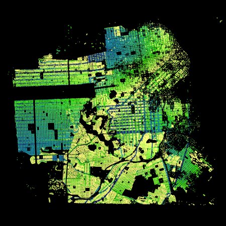
Paint by Numbers – SF Addresses « The Swordpress
1867
manhattan
new york
borough
city
commissioner
grid
map
plan
streets
What If Manhattan Was Designed Like Paris? | Untapped New York
aerial
black
coastline
geography
land
landscape
map
river
water
white
Maps Etc /
blue
city
map
river
road
stream
urban
water
watercolor
yellow
Maps Etc / Stamen is releasing watercolor maps - and this is London
usa
black
border
continent
country
map
outline
rivers
states
white
Bodies of water most closely connected to US national boundaries | Flickr - Photo Sharing!
aerial
city
green
isometric
landscape
layout
map
plan
street
urban
Patterns | Creative Arts Unlimited
art
geography
globe
illustration
lines
map
retro
travel
vintage
world
Pan Am's World | Flickr - Photo Sharing!
1940
us
usa
census
cities
demography
geography
map
population
states
Population Graphic | Flickr - Photo Sharing!
abstract
aerial
city
geometric
grid
landscape
map
mountains
town
urban
TM SGM RSI 4/1978 | Flickr - Photo Sharing!
journey
circles
eclipse
globe
map
numbered
path
route
solar
world
Cape Canaveral JFK Space Center | Flickr - Photo Sharing!
atlas
continents
countries
geography
globe
map
pins
travel
world
world map
Alexis Madrigal - Authors - The Atlantic
continents
earth
globe
gray
map
outline
simple
topography
white
world
Blurred map | Flickr - Photo Sharing!
astronauts
computers
control
launch
map
mission control
nasa
room
space
tracking
What John Glenn Saw When He Became the First American to Orbit Earth - Alexis Madrigal - Technology - The Atlantic
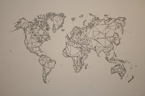
black
continents
geometric
globe
map
outline
polygonal
triangle
white
world
tumblr_ll97dyoqxW1qbvboao1_1280.jpg 1280×853 pixels
europe
atlas
blue
borders
continent
continents
countries
dots
geographical
geography
globe
location
map
ocean
political
regions
travel
world
lines of law and commerce | Flickr - Photo Sharing!
city
directions
location
map
network
road
roads
street
streets
travel
TRNSPRTNATION | London
london
uk
city
light
map
network
night
roads
streets
traffic
City B - Paint by Tweets | Flickr - Photo Sharing!
abstract
black
city
design
grid
layout
map
streets
urban
white
San Francisco Map Sketch - Ink | Flickr - Photo Sharing!
san francisco
city
flow
flow map
map
street
streets
traffic
travel
urban
San Francisco Traffic Survey: Street Car Flow Map (1937) | Flickr - Photo Sharing!