found.husk.org
images.
tagged land.
13 images.
bay
coastline
detail
geography
land
map
ocean
river
topography
water
"8-bit" hachures | Flickr - Photo Sharing!
manhattan
nyc
new york
walmart
acres
area
comparison
land
size
square footage
Logistics, Territory and Walmart: All Those Numbers: Places: Design Observer
aerial
black
coastline
geography
land
landscape
map
river
water
white
Maps Etc /
film
instruction
land
paper
photo
polaroid
protection
remove
sx-70
warning
Original 1976 Polaroid SX-70 Land Film Darkslide | Flickr - Photo Sharing!
analog
camera
film
instant
land
photography
polaroid
retro
sx-70
vintage
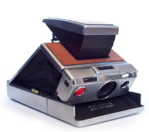
SX-70 cutaway view
blue
clouds
coast
earth
land
planet
satellite
sky
space
water
Zeeland 2 London #FromSpace taken May 3rd '11 @ 5:28pm GMT on Twitpic
europe
black
continent
forest
green
land
landmass
map
red
satellite
Europe In Place Names – Source: Geonames Database, January 2011
bay
blue
city
coast
green
land
map
rural
urban
water
Original BART proposal | Flickr - Photo Sharing!
atlas
book
geography
islands
land
map
ocean
remote
sea
travel
The Book Bench: Islands in the Storm : The New Yorker
chart
country
economy
graph
infographic
land
map
pie
pizza
world
The Economist: Crop | Ads of the World: Creative Advertising Archive & Community
classic
film
model
retro
toy
vintage
camera
instant
lego
polaroid
camera
film
instant
land
lego
model
photo
polaroid
toy
Brickshelf Gallery
polaroid
camera
classic
film
instant
land
retro
silver
square
vintage
Image:Sx70-2.jpg - Wikipedia, the free encyclopedia
aerial
bay
city
coastline
earth
land
ocean
satellite
view
water
New York City in Winter (NASA, International Space Station, 01/09/11) | Flickr - Photo Sharing!


