found.husk.org
images.
tagged europe.
22 images.
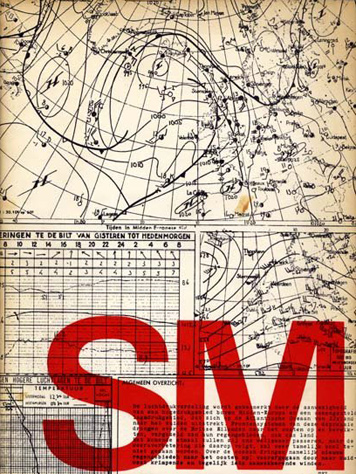
chart
dutch
europe
forecast
graphic
map
red
typography
vintage
weather
Design Observer
europe
locations
map
maritime
nautical
ocean
sea
ships
travel
world
Marine Traffic | Flickr - Photo Sharing!
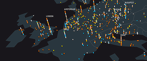
europe
connections
data
globe
grid
lines
map
network
night
travel
Math/Code / remixing Eric Fischer
europe
atlas
blue
borders
continent
continents
countries
dots
geographical
geography
globe
location
map
ocean
political
regions
travel
world
lines of law and commerce | Flickr - Photo Sharing!
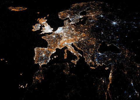
europe
city
dark
earth
globe
lights
map
night
satellite
stars
European detail map of Flickr and Twitter locations | Flickr - Photo Sharing!
europe
black
continent
forest
green
land
landmass
map
red
satellite
Europe In Place Names – Source: Geonames Database, January 2011
airport
brochure
conference
europe
hotel
london
map
skyway
travel
world
Skyway Hotel, London Heathrow Airport - conference brochure, c1960 | Flickr - Photo Sharing!
cities
destinations
europe
geography
global
globe
map
travel
world
world map
thesearethings — World Map / Black
belgium
denmark
europe
germany
ireland
netherlands
norway
sweden
uk
europe
location
map
maritime
nautical
ocean
sea
shipping
vessels
belgium
denmark
europe
germany
ireland
netherlands
norway
sweden
uk
europe
location
map
maritime
nautical
ocean
sea
shipping
vessels
The Map Room: Dumped Munitions in the North Atlantic
britain
city
density
england
europe
ireland
map
population
town
village
flocal admins / the UK is weird | Flickr - Photo Sharing!
europe
germany
journey
railroad
railway
station
sunset
tracks
train
transportation
Photo Gallery: On the Right Tracks? - SPIEGEL ONLINE - News - International
19th century
20th century
europe
great powers
alliances
diplomacy
history
international relations
network
world war
The Enemy of My Enemy - Opinionator Blog - NYTimes.com
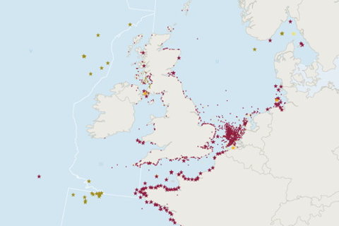
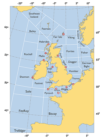
atlantic
british isles
europe
ireland
north sea
uk
coast
grid
map
ocean
UK_shipping_forecast_zones.png (PNG Image, 960×1280 pixels) - Scaled (47%)
1933
europe
air
airline
flight
map
network
plan
routes
travel
Figures
europe
france
london
motorrail
paris
posters
seallink
train
travel
vintage
grain edit · British Railways Memorabilia
1962
airline
boac
britain
europe
independent
plane
tours
travel
vintage
Flickr Photo Download: Independent tours
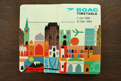
airline
airplane
boac
brochure
europe
retro
schedule
timetables
travel
vintage
grain edit · 1960s BOAC Timetable
europe
chart
cities
design
distance
distances
graphic
journey
kilometers
map
rail
railway
travel
vintage
swissmiss: Vintage Travel Brochure Graphics
europe
airline
cities
countries
data
flight
map
routes
transportation
travel
visualization
world
VisualizingLastfm
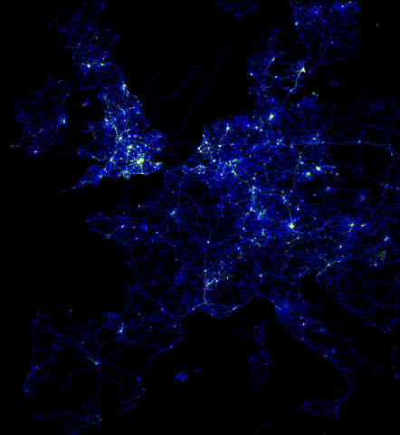
europe
city
image
lights
map
network
night
roads
satellite
travel
Image:EuropeGPSpoints.png - OpenStreetMap
asia
china
cloud
europe
language
map
russia
tag
words
world
ausschnitt_europa.png 1242×767 pixels
france
europe
map
old
poster
railroad
railway
train
travel
vintage
Affiche on Flickr - Photo Sharing!


