found.husk.org
images.
tagged aerial.
page 1 of 3 with 60 images.
abstract
aerial
architecture
buildings
cityscape
design
futuristic
graphic
illustration
urban
- NEWWORK MAGAZINE ISSUE Nº1 -
netherlands
aerial
agriculture
bloom
colors
farmland
fields
flowers
landscape
tulips
aesthetics of joy » Blog Archive » Technicolor landscapes
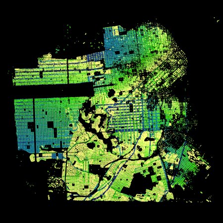
aerial
city
development
green
grid
map
plan
satellite
streets
urban
Paint by Numbers – SF Addresses « The Swordpress
aerial
black
coastline
geography
land
landscape
map
river
water
white
Maps Etc /
aerial
city
green
isometric
landscape
layout
map
plan
street
urban
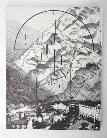
Patterns | Creative Arts Unlimited
abstract
aerial
city
geometric
grid
landscape
map
mountains
town
urban
TM SGM RSI 4/1978 | Flickr - Photo Sharing!
aerial
buildings
cityscape
gray
infrastructure
model
overhead
streets
urban
view
stamen design | Goings on
1930s
aerial
airship
architecture
building
city
modern
skyscraper
urban
vintage
angel flores jr - Not Just a Perch for King Kong The mooring mast atop the Empire State Building was said to be for dirigibles. But it also made the building taller than its rival for height, the Chrysler Building.
aerial
canal
cityscape
grass
houses
landscape
neighborhood
river
suburban
water
Shop | Park Life
aerial
city
cityscape
grid
london
map
network
overhead
street
urban
SIMON ELVINS
aerial
atmospheric
clouds
cloudscape
earth
natural
satellite
sky
space
weather
Winter Cloud Streets, North Atlantic : Image of the Day
la
aerial
city
cityscape
freeway
highway
infrastructure
roads
traffic
urban
Prix Pictet - Shortlist 2010 - Edward Burtynsky - Highway #5
aerial
architecture
buildings
city
cityscape
downtown
metropolis
skyscrapers
urban
view
epic on the Behance Network
aerial
alcatraz
bay
bridge
city
island
landscape
san francisco
view
water
All sizes | Alcatraz Island, Treasure Island (NASA, International Space Station Science, 01/28/10) | Flickr - Photo Sharing!
aerial
cold
frozen
landscape
river
snow
stream
white
winding
winter
Paul Octavious - JFK ✈ SFO
aerial
architecture
buildings
city
cityscapes
landscape
park
satellite
urban
And Now Presenting: Amazing Satellite Images Of The Ghost Cities Of China
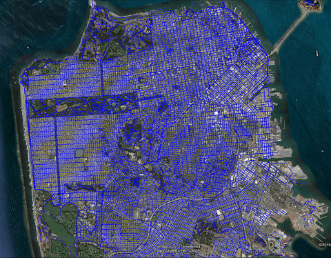
san francisco
aerial
blue
city
grid
map
network
roads
street
urban
Where I've been | Flickr - Photo Sharing!
race track
aerial
asphalt
circuit
curves
desert
landscape
motorsport
racing
track
Andreas Gursky - Selected Works - Matthew Marks Gallery
aerial
city
cityscape
concrete
freeway
highway
infrastructure
roads
traffic
urban
The Believer - Michael Light - LA NIGHT
aerial
bridge
city
freeway
highway
interchange
overpass
road
traffic
urban
470-light_m.jpg 576×460 pixels
aerial
dirt
drone
field
grass
landscape
overhead
path
road
trees
panoramic | Flickr - Photo Sharing!
aerial
black
caption
footage
movie
overhead
screen
text
view
white
scraplab — “A navigable terrain of spatialized data”
aerial
aerial view
bridge
bridges
building
city
city lights
cityscape
metropolis
new york
night
photo booth
skyline
urban
urban city
edfella.com
aerial
blocks
city
design
layout
map
plan
streets
town
urban
Isle of Dogs | Flickr - Photo Sharing!


