found.husk.org
images.
tagged geography.
page 1 of 2 with 26 images.
blue
county
election
geography
map
politics
purple
red
state
voting
Adults and children, saturated by log of density | Flickr - Photo Sharing!
bay
coastline
detail
geography
land
map
ocean
river
topography
water
"8-bit" hachures | Flickr - Photo Sharing!
cartography
earth
flat
geography
globe
grid
mapmaking
projection
world map
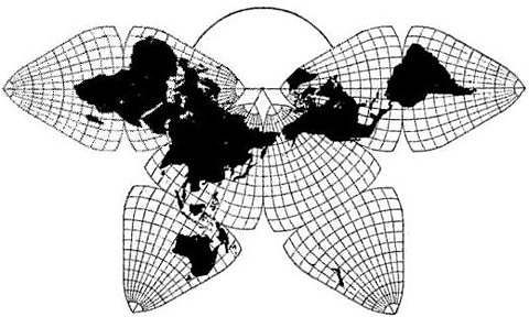
8) Critique of Fuller's Dymaxion Map compared to B.J.S. Cahill's Octahedral
geography
glasses
globe
man
map
professor
science
serious
suit
world
2) Critique of Fuller's Dymaxion Map compared to B.J.S. Cahill's Octahedral
buckminster
design
dymaxion
fuller
geographer
geography
globe
map
political
world
2) Critique of Fuller's Dymaxion Map compared to B.J.S. Cahill's Octahedral
aerial
black
coastline
geography
land
landscape
map
river
water
white
Maps Etc /
art
geography
globe
illustration
lines
map
retro
travel
vintage
world
Pan Am's World | Flickr - Photo Sharing!
1940
us
usa
census
cities
demography
geography
map
population
states
Population Graphic | Flickr - Photo Sharing!
atlas
continents
countries
geography
globe
map
pins
travel
world
world map
Alexis Madrigal - Authors - The Atlantic
europe
atlas
blue
borders
continent
continents
countries
dots
geographical
geography
globe
location
map
ocean
political
regions
travel
world
lines of law and commerce | Flickr - Photo Sharing!
antique
atlas
cartography
geography
illustration
maps
old
travel
vintage
world
free vintage desktop wallpaper from maraid | Flickr - Photo Sharing!
america
usa
country
data
geography
map
nation
points
states
united
U.S. City Labels, z4-z7 | Flickr - Photo Sharing!
chart
coastline
geography
island
map
nautical
navigation
ocean
scotland
sea
Local Magnetic Anomalies | Flickr - Photo Sharing!
earth
equator
geography
globe
latitude
lines
longitude
map
meridian
world
File:Lines of equal latitude and longitude FROM (World map Winkel Tripel proj-0deg centered.svg).PNG - Wikipedia, the free encyclopedia
borders
continents
countries
earth
geography
globe
international
map
political
world
File:Lines of equal latitude and longitude FROM (World borders parallel.png).PNG - Wikipedia, the free encyclopedia
aged
antique
atlas
design
faded
geography
map
paper
travel
vintage
maps : LUIS DOURADO
cities
destinations
europe
geography
global
globe
map
travel
world
world map
thesearethings — World Map / Black
atlas
book
geography
islands
land
map
ocean
remote
sea
travel
The Book Bench: Islands in the Storm : The New Yorker
branch
delta
geography
map
network
river
stream
tributary
water
watercourse
Flickr Photo Download: London Waterways
projection
continents
distorted
earth
flat
geography
global
globe
map
world
BLDGBLOG: Cracking the Planet
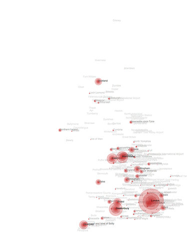
england
uk
cities
country
density
geography
location
map
population
size
Flickr Photo Download: Top placenames from BBC search on July 9th
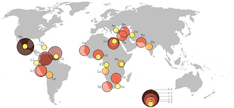
circles
countries
data
distribution
geography
global
map
regions
visualization
world map
File:Principaux Bidonvilles.png - Wikimedia Commons
book
building
city
economics
economy
geography
skyline
spatial
trade
urban
Book Covers
data
dots
geography
global
globe
journey
location
map
travel
world
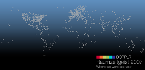
Flickr Photo Download: Coming soon...


.PNG)
.PNG)