found.husk.org
images.
tagged map.
page 9 of 13 with 305 images.
art
city
collection
found
london
lost
map
museum
platform
transport
Poster 2005/15834 - Poster and poster artwork collection, London Transport Museum
analysis
chart
coordinates
diagram
graph
grid
magnifying glass
map
numbers
zoom
(no title)
factory
puzzle
boxes
diagram
fork
lift
map
plan
project
route
truck
warehouse
project 5 book cover on Flickr - Photo Sharing!
1960s
london
city
diagram
flow
map
network
roads
traffic
vehicles
traffic_flow_map_small.jpg (image)
abstract
city
design
graphic
illustration
london
map
poster
street
typography
AK2294
1933
europe
air
airline
flight
map
network
plan
routes
travel
Figures
airport
flight
lines
map
navigation
paths
planes
routes
runways
travel
hughen.airport.sfo.oak
border
coast
country
england
fantasy
green
ireland
map
north
sea
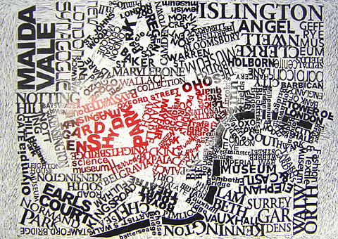
334 - The Atlas of True Names « Strange Maps
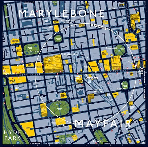
london
city
district
england
guide
map
marylebone
mayfair
streets
travel
Close up of the Legible London mapping at Legible London
city
design
layout
london
map
plan
railway
roads
street
traffic
The Elephant in Context | The Car & The Elephant
design
city
infrastructure
layout
map
network
plan
roads
streets
urban
but does it float
bus
city
density
diagram
edinburgh
map
routes
scotland
services
transport
british-transport-commission_passenger-transport-in-glasgow-and-district_1951_density-of-scottish-bus-group-services_3000_3099_600.jpg (JPEG Image, 3000x3099 pixels) - Scaled (25%)
abstract
black
city
design
exhibition
geometric
graphic
map
poster
white
some posters on the Behance Network
london
art
city
design
graphic
illustration
map
poster
typography
urban
London : Mark Andrew Webber
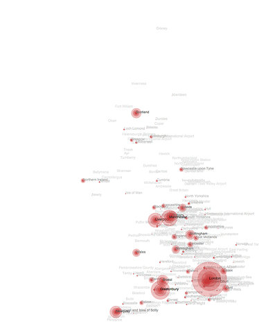
england
uk
cities
country
density
geography
location
map
population
size
Flickr Photo Download: Top placenames from BBC search on July 9th
building
exhibit
floorplan
gallery
guide
levels
london
map
museum
A Daily Dose of Architecture: Building Diagrams
control
dark
globe
man
map
monitor
operator
radar
room
screen
Real-Time 3D Air Traffic Network Simulation Installation - information aesthetics
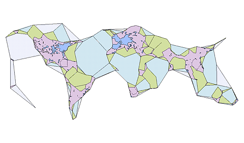
gis
map
cartography
composite
data
geographic
illustration
layers
overlay
visualization
TopOSM - OpenStreetMap
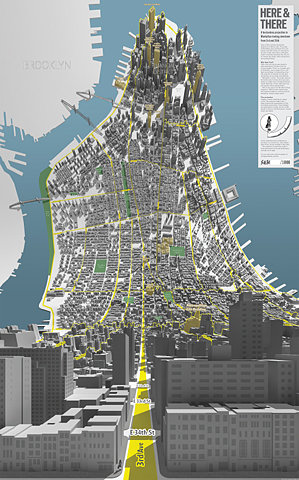
3d
manhattan
nyc
aerial
buildings
city
map
perspective
streets
urban
Here & There — a horizonless projection in Manhattan
icons
patterns
google earth
symbols
city
design
geometric
graphics
map
urban
New Work: Newark Gateways | New at Pentagram | Pentagram
abstract
city
design
geometric
graphic
icons
map
plan
symbols
urban
Storefront for Art and Architecture | Bookstore
london
venice
architecture
city
comparison
design
docks
map
river
urban
things to look at: New vs Old
borders
cartographic
coastline
country
geographic
island
landmass
map
outline
terrain
Flickr Photo Download: SHAPEZ (2009-03-24)
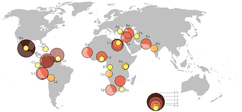
circles
countries
data
distribution
geography
global
map
regions
visualization
world map
File:Principaux Bidonvilles.png - Wikimedia Commons


