found.husk.org
images.
tagged navigation.
16 images.
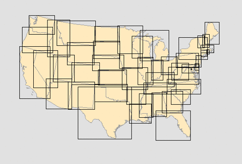
city
infrastructure
map
navigation
network
river
roads
streets
transportation
urban
oneYearLND09-10_101115-large.jpg (2362×1662)
chart
coastline
geography
island
map
nautical
navigation
ocean
scotland
sea
Local Magnetic Anomalies | Flickr - Photo Sharing!
city
diagram
grid
guide
layout
map
navigation
plan
street
urban
2010 End-of-the-Year Card
usa
charts
coast
map
nautical
nautical chart
navigation
ocean
sailing
sea
Unlocking the Mysteries of the Bounding Box
circular
design
highways
map
navigation
plate
platter
roads
travel
vintage
30's London map dish | Flickr - Photo Sharing!
bubble
instrument
mark ii
nautical
navigation
optical
plan
rangefinder
section
sextant
Flickr Photo Download: sci_museum_sextant_diagrams.jpg
city
direction
folded
folding
guide
map
navigation
paper
tourism
travel
Buy a London Map - The Zoomable Map
airport
flight
lines
map
navigation
paths
planes
routes
runways
travel
hughen.airport.sfo.oak
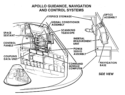
apollo
command
computer
control
guidance
inertial
module
navigation
spacecraft
systems
ad009.gif (GIF Image, 1100×840 pixels) - Scaled (86%)
buttons
control
data
display
keyboard
lights
navigation
panel
register
system
Apollo Guidance Computer Schematic on Flickr - Photo Sharing!
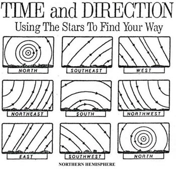
celestial
direction
east
hemisphere
navigation
north
south
stars
time
west
star_trails.jpg 350×335 pixels
antique
exploration
geography
globe
history
map
navigation
travel
vintage
world
DW-WORLD
beacon
coast
guide
lighthouse
maritime
navigation
ocean
safety
sea
tower
Siggi Eggertsson
london
buildings
city
directions
guide
landmarks
location
map
navigation
street
Where are the signs at Legible London
meteorology
atlantic
chart
forecast
globe
grid
lines
map
nautical
navigation
ocean
weather
Flickr Photo Download: DSC00390a
aerial
city
maps
navigation
road
route
signs
street
street signs
traffic
Cube_Wired_01 on Flickr - Photo Sharing!


