found.husk.org
images.
tagged map.
page 7 of 13 with 305 images.
england
scotland
uk
wales
country
density
dots
green
map
population
Geonames Maps « optional.is/required
2004-2010
art
artwork
design
london
map
poster
transport
tube
underground
Art on the Underground - - New Tube map cover by Barbara Kruger
1666
1799
city
development
expansion
growth
historic
london
map
squares
▱ GOOGLE URBANISM™ The Urban Development of London 1666 - 1799
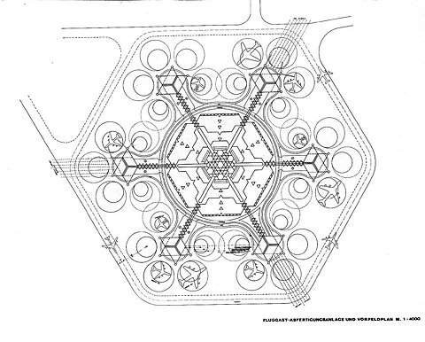
architecture
hexagon
airfield
airport
design
layout
map
plan
schematic
02gross.jpg 1000×804 pixels
airline
city
guide
journey
map
pan am
retro
tourism
travel
vintage
Container List: From Rome to Rio
london
city
infrastructure
map
network
river
streets
transportation
urban
Flickr Photo Download: The Geotaggers' World Atlas #2: London
california
film
hollywood
location
map
movie
paramount
set
studio
travel
Flickr Photo Download: Paramount Studio map of California's geographical facsimiles, fron The Motion Picture Industry as a Basis for Bond Financing, 1927
san francisco
city
city-scape
data
lines
map
network
route
transportation
travel
Flickr Photo Download: Motion within San Francisco / Berkeley / Oakland recorded by geotagging photographers
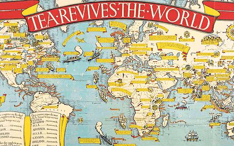
antique
globe
graphic
illustration
map
poster
retro
tea
vintage
world
At last I can see the point of maps - Telegraph
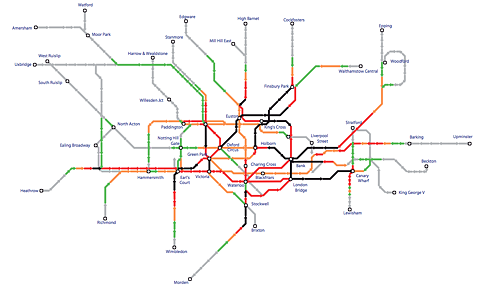
city
london
map
network
railway
subway
transport
travel
tube
underground
Flickr Photo Download: Tube crowding, 2006
olivetti
architecture
building
buildings
design
factory
industrial
location
map
office
Flickr Photo Download: Olivetti Advertising
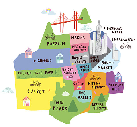
bicycle
california
city
districts
guide
map
neighborhoods
san francisco
travel
usa
city
districts
guide
locations
map
neighborhoods
tourism
travel
bicycle
california
city
districts
guide
map
neighborhoods
san francisco
travel
usa
city
districts
guide
locations
map
neighborhoods
tourism
travel
Chloe Fleury//Illustration
england
london
city
detailed
historical
map
roads
streets
topography
urban
Projects
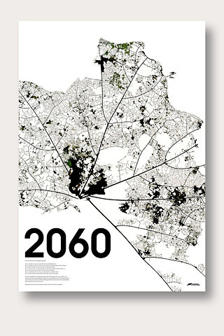
2060
city
design
future
futuristic
grid
lines
map
structure
urban
Studio8 Design +44 (0)20 7251 6430
city
diagram
grid
infrastructure
lines
map
network
plan
streets
urban
Computer City Project - Archigram Archival Project
advisory
ash
aviation
eruption
flight
forecast
levels
map
plume
volcanic
Iceland volcano: volcanic eruptions and activity around the world, with coordinates | News | guardian.co.uk
england
london
uk
city
fold
guide
map
street
tourism
travel
Flickr Photo Download: You Are Here: Freelancer's Map of London
atlas
book
defence
dutch
line
map
new
water
BLDGBLOG: Quick Links 9
branch
delta
geography
map
network
river
stream
tributary
water
watercourse
Flickr Photo Download: London Waterways
aerial
buildings
city
design
layout
map
plan
roads
street
urban
Ballardian » The Real Concrete Island?
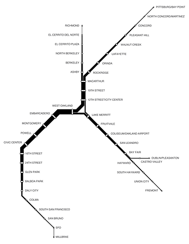
bart
bay area
california
line
map
route
subway
train
transit
transportation
BART+Ridership-small.png (image)
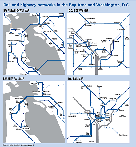
bay area
city
d.c.
highway
map
network
rail
subway
transit
transportation
washington
SPUR | Learning from Metrorail
airport
charles
de
diagram
france
gaulle
map
paris
runway
Facebook | SIXPACK FRANCE's Photos - "La Jetée" collection, Fragments of Yesterday part 03.
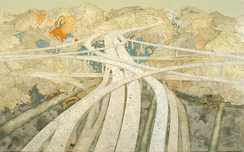
interchange
abstract
aerial
freeway
highway
landscape
map
overhead
pattern
roads
Matthew Cusick Art


