found.husk.org
images.
tagged bay.
11 images.
bay
coastline
detail
geography
land
map
ocean
river
topography
water
"8-bit" hachures | Flickr - Photo Sharing!
bay
california
detail
historical
map
old
peninsula
san francisco
topographic
vintage
Stages of development of the San Bruno Turnpike/Bayshore Highway (2002) | Flickr - Photo Sharing!
bay
city
coast
dark
earth
lights
night
space
view
water
California's Bay Area at Night (NASA, International Space Station, 12/26/10) | Flickr - Photo Sharing!
area
bay
consultants
design
development
engineering
program
rapid
train
transit
Bay Area Rapid Transit Development Program (February-June, 1964) | Flickr - Photo Sharing!
aerial
alcatraz
bay
bridge
city
island
landscape
san francisco
view
water
All sizes | Alcatraz Island, Treasure Island (NASA, International Space Station Science, 01/28/10) | Flickr - Photo Sharing!
bay
blue
city
coast
green
land
map
rural
urban
water
Original BART proposal | Flickr - Photo Sharing!
art
bay
bridge
city
colorful
map
mosaic
oakland
san francisco
tile
tiley maps! | Flickr - Photo Sharing!
area
bay
death
lives
money
rapid
time
transit
vote
yes
1962: SAVE the BAY AREA from CHOKING to DEATH (with BART)! « Spots Unknown San Francisco
bay
city
contour
elevation
grid
hills
map
san francisco
streets
topographic
(no title)
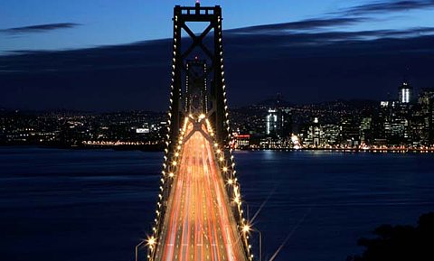
bay
bridge
city
cityscape
golden gate
lights
night
san francisco
traffic
urban
24 hours in pictures: January 31 2008 | World news | guardian.co.uk
aerial
bay
city
coastline
earth
land
ocean
satellite
view
water
New York City in Winter (NASA, International Space Station, 01/09/11) | Flickr - Photo Sharing!