found.husk.org
images.
tagged network.
page 2 of 6 with 122 images.
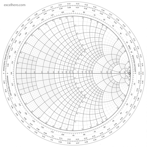
rf
smith
analysis
chart
coefficient
impedance
matching
network
reflection
smith_chart_full_size_excelhero.com.png 1480×1480 pixels
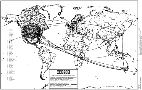
1996
communication
connectivity
global
internet
map
network
usenet
usenet-map
world
world_usenet_1986_large.gif (GIF Image, 1493x946 pixels)
usa
circles
clustered
connected
dots
filled
map
network
outline
states
indiemaps.com/blog » E00Parser, an ActionScript 3 parser for the Arc/Info Export topological GIS format
city
infrastructure
map
navigation
network
river
roads
streets
transportation
urban
oneYearLND09-10_101115-large.jpg (2362×1662)
city
design
grid
infrastructure
layout
maps
network
plan
route
urban
Umbrico : map
city
grid
infrastructure
map
network
plan
roads
streets
transportation
urban
Personal geography of 2010 | Flickr - Photo Sharing!
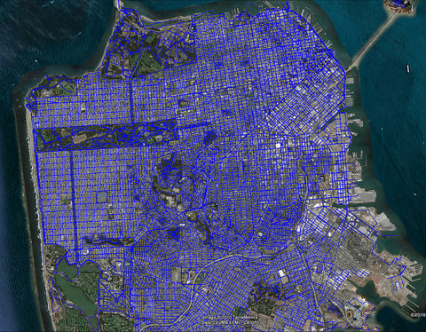
san francisco
aerial
blue
city
grid
map
network
roads
street
urban
Where I've been | Flickr - Photo Sharing!
boston
city
lines
map
network
routes
stations
subway
transit
transport
sss_BOSTON_sm | Flickr - Photo Sharing!
washington dc
city
design
diagram
grid
map
network
plan
streets
urban
bryanboyer
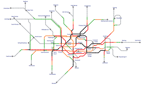
london
subway
city
map
metro
network
public
train
transportation
tube
Tim Fishlock
london
closed
disruptions
map
network
station
transport
travel
tube
underground
Westminster Tube closed | Flickr - Photo Sharing!
france
paris
blue
city
france
highways
map
network
paris
plan
roads
streets
transportation
Unfinished/Unconstructed/Demolished Highways/Motorways/Freeways - Page 2 - SkyscraperCity
antenna
communication
dish
metal
network
radio
satellite
structure
technology
telescope
Greg White – Photographer
california
density
grid
infrastructure
map
network
pattern
roads
system
transportation
urban
all streets | ben fry
pattern
abstract
city
lines
map
network
pink
roads
streets
white
four days in september (NYC) | Flickr - Photo Sharing!
abstract
graphic
green
lines
messy
net
network
swirls
texture
white
Bus-Tops: London, screens and the Olympics | booktwo.org
city
grid
lines
map
network
paths
streets
transportation
travel
urban
10 days in Montreal | Flickr - Photo Sharing!
london
city
infrastructure
map
network
river
streets
transportation
urban
Flickr Photo Download: The Geotaggers' World Atlas #2: London
san francisco
city
city-scape
data
lines
map
network
route
transportation
travel
Flickr Photo Download: Motion within San Francisco / Berkeley / Oakland recorded by geotagging photographers
city
london
map
network
railway
subway
transport
travel
tube
underground
Flickr Photo Download: Tube crowding, 2006
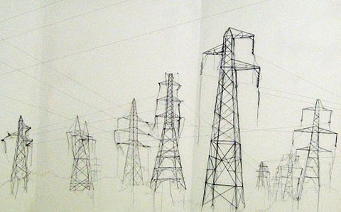
electrical
energy
grid
infrastructure
network
power lines
pylons
towers
transmission
wires
london design festival 08: debbie smyth at tent london
branch
delta
geography
map
network
river
stream
tributary
water
watercourse
Flickr Photo Download: London Waterways
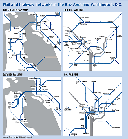
bay area
city
d.c.
highway
map
network
rail
subway
transit
transportation
washington
SPUR | Learning from Metrorail
abstract
connection
data
graph
lines
network
nodes
points
relationships
visualization
i’m a lumberjaph » Blog Archive » Github explorer


